50000
Type of resources
Available actions
Topics
Keywords
Contact for the resource
Provided by
Years
Formats
Representation types
Update frequencies
status
Scale
-
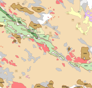
The Superficial deposits 1:20 000 / 1:50 000 data include material produced during the period 1972-2007 for land use planning, for the mapping and inventory of the natural resources as well as for environmental management and for scientific research. The main mapping scale has been 1:10 000. The data contains a sediment as a basal deposit at a depth of one metre. The minimum size of the basal deposit polygon is two hectares, with islands, mire and field enclosures, as well as geologically significant sites as an exception. The 0.4-0.9 m thick layers are described as overlying the basal deposit and, in geologically or economically significant cases, such layers could be even thicker. The minimum polygon size of the overlying deposit is usually four hectares. Thin covering layers under 0.4 m in thickness, which are difficult to delimit but effect an area of at least four hectares, are displayed as point data. Besides the deposits Quaternary geological formations formed in different ways, such as eskers and hummocky moraines, are described in the data. Other mapping sites such as small rock exposures, dunes and raised beaches are shown as point or line data. Coordinate reference system of the Superficial deposits 1:20 000 / 1:50 000 was transformed in March 2013. The transformation from Finnish National Grid Coordinate System (Kartastokoordinaattijärjestelmä, KKJ) Uniform Coordinate Frame to ETRS-TM35FIN projection was done by using the three-dimensional transformation in accordance with the recommendations for the public administration JHS154.
-
The EMODnet (European Marine Observation and Data network) Geology project collects and harmonizes marine geological data from the European sea areas to support decision making and sustainable marine spatial planning. The partnership includes 39 marine organizations from 30 countries. The partners, mainly from the marine departments of the geological surveys of Europe (through the Association of European Geological Surveys-EuroGeoSurveys), have assembled marine geological information at various scales from all European sea areas (e.g. the White Sea, Baltic Sea, Barents Sea, the Iberian Coast, and the Mediterranean Sea within EU waters). This multiscale dataset includes EMODnet seabed substrate maps at a scale of 1:1 500, 1:5 000, 1:10 000, 1:15 000, 1:20 000, 1:25 000, 1:30 000, 1:45 000, 1: 50 000, 1:60 000, 1:70 000 from the European marine areas. Traditionally, European countries have conducted their marine geological surveys according to their own national standards and classified substrates on the grounds of their national classification schemes. These national classifications are harmonised into a shared EMODnet schema using Folk's sediment triangle with a hierarchy of 16, 7 and 5 substrate classes. The data describes the seabed substrate from the uppermost 30 cm of the sediment column. Further information about the EMODnet Geology project is available on the portal (http://www.emodnet-geology.eu/).
-
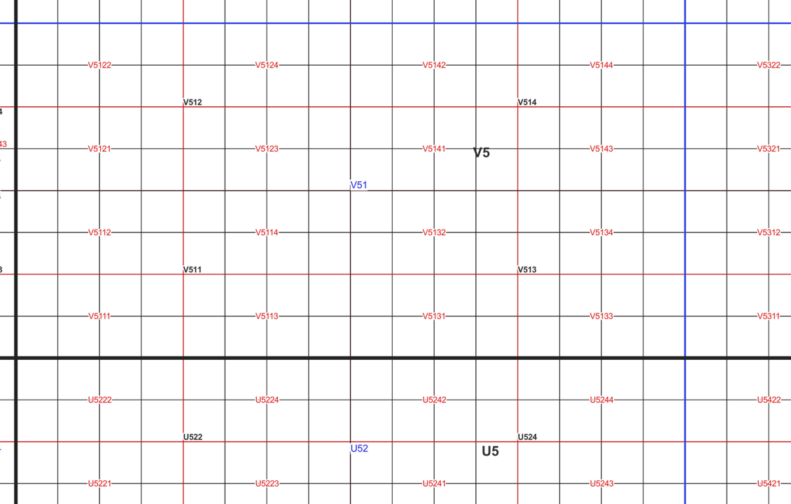
The map sheet division is a system created for printing maps, which covers map sheet codes, map scales and map sheet sizes. The map sheet division is a system created for printing maps, which covers map sheet codes, map scales and map sheet sizes. Today, map sheet division is also used for other purposes. It is also possible to download other NLS datasets in addition to maps in accordance with map sheet division. The map sheet division TM35, which is based on the projected coordinate reference system ETRS-TM35FIN is in use today. Before 2007, a map sheet division that was based on the KKS coordinate reference system was used. The TM35 map sheet division consists of 7 different grid sizes, the smallest scale is 1:200,000 and the largest is 1:5000. An explanation of how the grids are further split into more detailed grids and the principles of map sheet numbering is on the National Land Survey website (in Finnish) https://www.maanmittauslaitos.fi/kartat-ja-paikkatieto/kartat/osta-kartta/nain-loydat-oikean-karttalehden. The attribute data of the grids include map sheet number, the area of a square on the grid, perimeter and the coordinates of the centre of the square. The map sheet division is available as a file in vector format and through our contract-based WMTS service in raster format. In addition, you can view it in the geoportal Paikkatietoikkuna. The product is a part of the open data of the National Land Survey.
-
The EMODnet (European Marine Observation and Data network) Geology project collects and harmonizes marine geological data from the European sea areas to support decision making and sustainable marine spatial planning. The partnership includes 39 marine organizations from 30 countries. The partners, mainly from the marine departments of the geological surveys of Europe (through the Association of European Geological Surveys-EuroGeoSurveys), have assembled marine geological information at various scales from all European sea areas (e.g. the White Sea, Baltic Sea, Barents Sea, the Iberian Coast, and the Mediterranean Sea within EU waters). This dataset includes EMODnet seabed substrate maps at a scale of 1:50 000 from the European marine areas. Traditionally, European countries have conducted their marine geological surveys according to their own national standards and classified substrates on the grounds of their national classification schemes. These national classifications are harmonised into a shared EMODnet schema using Folk's sediment triangle with a hierarchy of 16, 7 and 5 substrate classes. The data describes the seabed substrate from the uppermost 30 cm of the sediment column. Further information about the EMODnet Geology project is available on the portal (http://www.emodnet-geology.eu/).
-
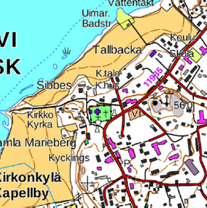
The Topographic map is a dataset depicting the terrain of all of Finland. The key elements in it are the road network, buildings and constructions, geographic names, waterways, land use and elevation. The more precise levels of the Topographic map consist of the same map objects and map symbols depicted in the same way as in the familiar Basic map. Basic map raster is applicable to be used, for instance, as a base map for planning land use or for excursion and outdoor recreational purposes in mobile devices and in various Internet services associated with nature. When going over to the more general datasets in the Topographic map, the number and visualisation of objects and map symbols changes. The generalised small-scale Topographic maps raster are applicable to be used as approach maps in e.g. mobile devices and Internet services. The product belongs to the open data of the National Land Survey of Finland.
-
-
-
-
-
 Paikkatietohakemisto