Land cover
Type of resources
Available actions
Topics
Keywords
Contact for the resource
Provided by
Years
Formats
Representation types
Update frequencies
Service types
Scale
-
The Finnish Forest Research Institute (Metla) developed a method called multi-source national forest inventory (MS-NFI). The first operative results were calculated in 1990. The first country level estimates correspond to years 1990-1994. Small area forest resource estimates, in here municipality level estimates, and estimates of variables in map form are calculated using field data from the Finnish national forest inventory, satellite images and other digital georeferenced data, such as topographic database of the National Land Survey of Finland. Nine sets of estimates have been produced for the most part of the country until now and eight sets for Lapland. These three themes have been produced for production of the CORINE2006. The products cover the combined land categories forest land, poorly productive forest land and unproductive land. The other land categories as well as water bodies have been delineated out using the elements of the topographic database of the Land Survey of Finland. The original map data can be downloaded from http://kartta.luke.fi/
-

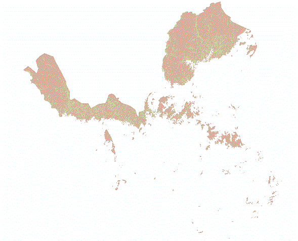
Saaristoluokitus on tilastollinen ja paikkatietopohjainen alueluokitus, jossa Suomen alueet luokitellaan viiteen alueluokkaan. Saaristoluokituksen päätavoite on tunnistaa ja luokitella Suomen saaristoalueet ja saaristoa olosuhteiltaan muistuttavat manneralueet. Luokitus on toteutettu hallinnollisista rajoista riippumattomalla 250 metrin tilastoruutujaolla, joka mahdollistaa kuntia tarkemman alueiden luokittelun. Luokitus on muodostettu alueellisella yleistystasolla, jossa eri alueluokat erottuvat selkeinä kokonaisuuksina vähintään seudullisella tai maakunnallisella mittakaavatasolla. Luokituksen avulla saadaan tietoa erityyppisten saaristoalueiden ja saaristomaisten manneralueiden kehityksestä koko maan tasolla. Saaristoluokituksesta on olemassa vuoden 2021 tilannetta kuvaava versio. Aineisto kuuluu SYKEn avoimiin aineistoihin (CC BY 4.0). Lisätietoja: https://www.syke.fi/fi/ymparistotieto/kartta-ja-tietopalvelut/elinympariston-tietopalvelu-liiteri/ykr-aineistojakelu
-
Soiden ojitustilanne –paikkatietoaineisto on rasterimuotoinen (25 m x 25 m) aineisto joka luokittaa koko Suomen turvemaat ojittamattomiin, ojitettuihin ja turpeenottoalueisiin. Aineisto on tehty MML:n maastotietokannan (vuosi 2008) ja CORINE2006 maanpeiteaineistojen avulla. Aineiston käytön yhteydessä on syytä mainita aineiston nimi SOJT_09b1 koska ojitustilanneaineistosta on käytössä eri versioita. Lähtöaineistona käytetty vuoden 2008 MML:n maastotietokantaa sekä vuoden 2006 CORINE maanpeiteaineistoa. Käyttötarkoitus: Suomen turvemaiden ojitustilanteen selvittäminen
-

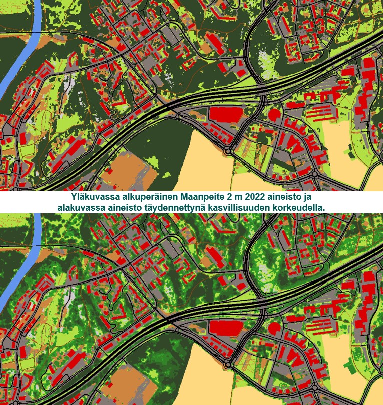
Maanpeite 2 m 2022 -aineisto kuvaa maanpeitettä valtakunnallisesti. Aineisto on rasteripohjainen ja sen pikselikoko on 2 m. Aineistossa on keskitytty etenkin pinnoitetun (läpäisemättömän) ja pinnoittamattoman (läpäisevän) maanpeitteen tarkkaan erottamiseen, johon on hyödynnetty Scalgon kehittämää tekoälyyn (AI U-NET) pohjautuvaa NDVI-ilmakuvatulkintaa. Tuotannossa on hyödynnetty Maanmittauslaitoksen ilmakuvia ja maastotietokantaa sekä Väyläviraston Digiroad-aineistoa. Aineistossa on seuraavat maanpeiteluokat: Pikselin arvo / pixel value - Luokan selite / class value - 111 päällystetty tie / paved road (Digiroad) - 112 päällystämätön tie / unpaded road (Digiroad) - 120 rakennus / building (Maastotietokanta) - 130 muu vettä läpäisemätön pinta / other impervious land (AI) - 211 pelto / field (Maastotietokanta) - 212 muu avoin matala kasvillisuus / shallow-vegetation (AI) - 220 korkea kasvillisuus / dense-vegetation (AI) - 310 avokalliot / bare-rock (Maastotietokanta) - 410 paljas maa / bare-land (AI) - 510 vesi / water (Maastotietokanta) Aineistoa on jatkojalostettu Suomen ympäristökeskuksessa (Syke) sisältämään tiedon kasvillisuuden korkeudesta Suomen metsäkeskuksen valtakunnalliseen laserkeilauksella tuotetettuun latvusmalliin perustuen. Jatkojalostuksen myötä syntyneitä uusia luokkia ovat: - 213 kasvillisuus alle 2 m / vegetation below 2 m - 231 kasvillisuus 2-5 m, sis. sähkölinjat / vegetation 2-5, inc. power lines - 232 kasvillisuus 5-10 m, sis. sähkölinjat / vegetation 5-10, inc. power lines - 233 kasvillisuus 10-15 m, sis. sähkölinjat / vegetation 10-15, inc. power lines - 234 kasvillisuus 15-20 m, sis. sähkölinjat / vegetation 15-20, inc. power lines - 235 kasvillisuus yli 20 m, sis. sähkölinjat / vegetation over 20 m, inc. power lines Kaikki luokat excel-taulukkona: https://geoportal.ymparisto.fi/meta/julkinen/dokumentit/land_cover_classes.xlsx Aineistot on tuotettu Scalgon ja Syken yhteistyönä osana Mammutti- ja TIIMA-hankkeita ja niitä voidaan käyttää paikkatietoanalyysien lisäksi myös taustakarttana. Aineistot kuuluvat Syken avoimiin aineistoihin (CC BY 4.0). Katselua varten esim. QGIS:ssä tai ArcGIS:ssä on käytössä WMS-rajapinta. Aineiston esittelyä varten on lisäksi laadittu karttapalvelu. Aineiston lataaminen esim. analysointia varten tehdään puolestaan WCS-rajapinnan kautta. Lataus on nopeinta tehdä selaimella koordinaattirajauksella (ETRS-TM35FIN) seuraavien esimerkkien mukaisesti: Maanpeite 2m 2022 -aineiston lataaminen Helsingin Viikistä GeoTIFF-formaatissa https://paikkatiedot.ymparisto.fi/geoserver/syke_maanpeitescalgo/wcs?service=WCS&version=2.0.1&request=GetCoverage&coverageId=Maanpeite2022Scalgo&SUBSET=N(6677650,6679380)&SUBSET=E(389470,392190)&subsettingcrs=http://www.opengis.net/def/crs/EPSG/0/3067&format=image/tiff Maanpeite 2m 2022 kasvillisuuden korkeudella -aineiston lataaminen Helsingin Viikistä GeoTIFF-formaatissa https://paikkatiedot.ymparisto.fi/geoserver/syke_maanpeitescalgo/wcs?service=WCS&version=2.0.1&request=GetCoverage&coverageId=Maanpeite2022kasvkorkScalgo&SUBSET=N(6677650,6679380)&SUBSET=E(389470,392190)&subsettingcrs=http://www.opengis.net/def/crs/EPSG/0/3067&format=image/tiff Kuvaustekniikka löytyy tästä zip-paketista QML- ja SLD-formaateissa: https://wwwd3.ymparisto.fi/d3/wcs_kuvaustekniikka/syke_maanpeitescalgo.zip Lisätietoja: Mapping Land cover for Finland.pdf (Scalgo): https://geoportal.ymparisto.fi/meta/julkinen/dokumentit/land_cover_scalgo.pdf Maanpeiteaineiston jatkojalostaminen (Syke): https://geoportal.ymparisto.fi/meta/julkinen/dokumentit/maanpeiteaineiston_jatkojalostaminen_syke.pdf The data represents the land cover of the whole Finland. The data are in raster-format having pixel size of 2 m. The data are especially focused on the accurate separation of paved and unpaved land cover, for which the artificial intelligence-based (U-NET) NDVI orthophoto interpretation developed by Scalgo has been used. The data has been further processed at the Finnish Environmental Institute (Syke) in classifying high and low vegetation based on the canopy height model of the Finnish Forestry Center. In addition to this, the existing spatial data from the Finnish National Land Survey and the Finnish Environment Institute was used to supplement the land cover data. The final dataset consists of 16 land cover classes. The data was produced in cooperation with Scalgo and Syke as part of the Mammutti- and TIIMA-projects and it can be used for various geospatial analysis and also as a background map. More information: Mapping Land cover for Finland(Scalgo): https://geoportal.ymparisto.fi/meta/julkinen/dokumentit/land_cover_scalgo.pdf
-
Soidensuojelun täydennysehdotuksen kohteet ovat soidensuojelutyöryhmän (2012-2015) tunnistamia, luonnonarvojensa puolesta valtakunnallisesti arvokkaita ja nykyistä suojelualueverkostoa parhaiten täydentäviä suoalueita. Aineisto sisältää soidensuojelutyöryhmän ehdotuksen mukaiset kohteet. Aineistosta ei poisteta alueita, vaikka niistä, tai niiden osista, perustetaan suojelualueita tai ne suojellaan muulla tavoin. Aineistossa on mukana soidensuojelun täydennysehdotuksen sekä Pohjois-Suomen kahdeksan lisäkohteen toteutetut valtionmaan kohteet koko maasta, jotka on hyväksytty valtioneuvostossa 30.3.2015 ja 14.4.2016 (Metsähallituksen alustava avaava tase). Aineistokokonaisuus koostuu soidensuojelutyöryhmän hyväksymistä kohderajauksista ja kohteiden luontotiedoista, valtionmaiden lakisääteisistä suojelualueista sekä Metsähallituksen pysyvällä päätöksellä suojelluista alueista. Aineisto sisältää seuraavat kokonaisuudet: 1. SoidenSuojTaydEhd: Soidensuojelun täydennysehdotuksen kohderajaukset 2. Suotyypit: Kohteilla maastokartoituksessa paikannetut suotyypit 3. SoidenSuojTaydEhdSuoyhdistymat: Kohteilla havaitut suoyhdistymätyypit -taulu. Yhdistyy SoidenSuojTaydEhd-alueisiin Kohdenro-kentän perusteella. 4. SoidenSuojTaydEhdErityispiirteet: Kohteilla havaitut alueelliset erityispiirteet –taulu. Yhdistyy SoidenSuojTaydEhd-alueisiin Kohdenro-kentän perusteella. 5. SoidenSuojTaydEhd_MH_lakikohteet: Valtioneuvoston 30.3.2015 ja 14.4.2016 (Metsähallituksen alustava avaava tase) hyväksymien, lakisääteisesti suojeltujen soidensuojelun täydennysehdotuksen valtionmaan kohteiden lopulliset kohderajaukset 6. SoidenSuojTaydEhd_MH_OmaPaatos: Valtioneuvoston 30.3.2015 ja 14.4.2016 (Metsähallituksen alustava avaava tase) hyväksymien, Metsähallituksen pysyvällä päätöksellä suojeltujen soidensuojelun täydennysehdotuksen valtionmaan kohteiden lopulliset kohderajaukset. Aineisto kuuluu SYKEn avoimiin aineistoihin (CC BY 4.0). Käyttötarkoitus: Luonnonsuojelun toteutukseen ja maankäytön suunnittelun sekä metsien käytön suunnittelun tueksi. Lisätietoja: https://geoportal.ymparisto.fi/meta/julkinen/dokumentit/SoidenSuojTaydEhd.pdf (ominaisuustietokenttien selitykset) https://helda.helsinki.fi/handle/10138/158285
-
Käytöstä poistunut maatalousmaa 2000-2020 -aineisto sisältää peltolohkorekisterin peltolohkot vuosilta 2000-2020 sekä tiedon viimeisestä tukivuodesta ja viljellystä kasvilajista peltolohkolla. Aineisto kuvaa todennäköisyyttä sille, että tietty peltolohko on maatalouskäytössä vuonna 2020. Aineisto on koostettu käyttäen Ruokaviraston tuottamaa peruslohkoaineistoa. Peruslohkoaineisto on komission asetuksen 796/2004 ja neuvoston asetuksen (EY) N:o 1782/2003 20 artiklassa tarkoitettu viljelylohkojen tunnistusjärjestelmä. Järjestelmää käytetään EU:n pinta-alaperusteisen maataloustuen hallinnoinnissa. Aineisto käsittää vuoden 2020 peruslohkojen tilanteen 31.12.2020. Peltolohkoihin on yhdistetty kaikkien lohkojen kasvitiedot vuosilta 2000-2020. Jokaiselta lohkolta löytyy tieto siitä, minä vuonna kyseinen lohko on viimeksi saanut maataloustukea, ja mitä lohkolla on tuona vuonna viljelty. Peltolohkoille on laskettu lisätietoa muista aineistoista. Tämä tieto kuvaa mahdollista maankäyttöluokan muutosta käytöstä poistuneilla pelloilla. Lisätietoa on laskettu seuraavista aineistoista: Corine land cover 2018 (https://ckan.ymparisto.fi/dataset/corine-maanpeite-2018): CORINE Land Cover 2018 kuvaa koko Suomen maankäyttöä ja maanpeitettä vuonna 2018. Aineisto on tuotettu Sykessä olemassa oleviin paikkatietoaineistoihin sekä satelliittikuvatulkintaan perustuen. Maankäyttöä/maanpeitettä kuvataan aineistossa nelitasoisella hierarkisella luokittelulla. Viisi pääluokkaa (rakennetut alueet; maatalousalueet; metsät sekä avoimet kankaat ja kalliomaat; kosteikot ja avoimet suot sekä vesialueet) jaetaan toisella tasolla yhteensä 15, kolmannella tasolla 31 ja neljännellä tasolla 49 alaluokkaan. Käytöstä poistunut maatalousmaa 2000-2020 -aineiston peltolohkoille on laskettu prosenttiosuudet viidestä pääluokasta. Maastotietokannan pellot, puutarhat ja niityt: Maanmittauslaitoksen Maastotietokanta on koko Suomen kattava maastoa kuvaava aineisto ja se koostuu erilaisista kohderyhmistä. Maastotietokannan Maatalousmaa -aineisto sisältää Maastotietokannan pellot, ja puutarhat. Niityt ovat erillinen kohdeluokka. Käytöstä poistunut maatalousmaa 2000-2020 -aineiston peltolohkoille on laskettu prosenttiosuudet näiden kolmen kohdeluokan yhdistelmästä. Kohdeluokat ja niiden kuvaukset löytyvät: https://www.maanmittauslaitos.fi/sites/maanmittauslaitos.fi/files/attachments/2018/03/Maastotietokohteet_0.pdf Mammutti-aineistot: Mammuttihankkeessa tuotettiin tietoa peltojen lisäksi kosteikoiden ja soiden, metsien ja rakennetun alueen maankäytöstä ja maanpeitteestä. Käytöstä poistunut maatalousmaa 2000-2020 -aineiston peltolohkoille on laskettu prosenttiosuudet kolmesta aineistosta: Yhdistelmäaineisto ennallistetuista soista, Maanpeite 2 m 2022 ja Puustoisen alan maski. Maanpeite 2 m 2022 aineistosta on laskettu seuraavien luokkien yhdistetty prosenttiosuus käytöstä poistuneella maatalousmaalla: päällystetty tie, päällystämätön tie, rakennus ja muu vettä läpäisemätön pinta. Aineistojen metatietokuvaukset löytyvä: Yhdistelmäaineisto ennallistetuista soista: https://ckan.ymparisto.fi/dataset/yhdistelmaaineisto-ennallistetuista-soista Maanpeite 2 m 2022: https://ckan.ymparisto.fi/dataset/maanpeite-2-m-2022-ja-jatkojaloste-kasvillisuuden-korkeudella Puustoisen alan maski on yhdistelmäaineisto metsäkeskuksen Metsämaskista ja Puustomaskista: https://www.metsakeskus.fi/sites/default/files/document/tietotuotekuvaus_metsamaski.pdf & https://www.metsakeskus.fi/sites/default/files/document/tietotuotekuvaus-puustomaski.pdf Laserkeilausaineistot: Lopulliseen tietotuotteeseen laserkeilausaineistoista laskettiin peltolohkoille ominaisuustiedoiksi kasvillisuuden latvuspeittoa ja korkeutta kuvaavat muuttujat. Nämä laskettiin Sykessä Mika Heikkisen toimesta tuotetuista 8m pikselin rasteriaineistoista laskemalla peltolohkoille latvuspeiton ja kasvillisuuden korkeuden keskiarvo ja maksimi, sekä keilausvuosi. Tämä tehtiin käyttäen sekä vanhaa, vuosina 2008-2019, tehtyjä keilauksia (pistetiheys 0.5p/m2, kattaa koko Suomen) sekä uutta, vuonna 2020 aloitettua laserkeilauskampanjaa (pistetiheys 5p/m2, ei kata tällä hetkellä koko Suomea). Latvuspeiton keskiarvo ja maksimi laskettiin aineistoista "Latvuspeitto, laserkeilattu (8m)" sekä "Latvuspeitto, Laserkeilausaineisto5p (8m) (FEO)", kasvillisuuden korkeuden maksimi aineistoista "Kasvillisuuden korkeus - highest, laserkeilattu (8m)" sekä "Kasvillisuuden korkeus - highest, Laserkeilausaineisto5p (8m) (FEO)" ja kasvillisuuden korkeuden keskiarvo aineistoista "Kasvillisuuden korkeus - average, laserkeilattu (8m)" sekä "Kasvillisuuden korkeus - average, Laserkeilausaineisto5p (8m) (FEO)". Aineistojen metatiedot löytyvät sivuilta "Kasvillisuuden rakenteellisuuden aineistot" https://ckan.ymparisto.fi/dataset/kasvillisuuden-rakenteellisuuden-aineistot-feo sekä "Puuston rakenteellisuusaineiston tietoseloste" http://geoportal.ymparisto.fi/meta/julkinen/dokumentit/Kasvillisuuden_rakenteellisuuden_aineistot.pdf. Ennen keskiarvon ja maksimin laskentaa NoData-arvot muutettiin nolliksi. Peltolohkoja bufferoitiin sisäänpäin 5 m jotta aineistojen sijaintivirheiden ja lohkon ulkopuolella olevan kasvillisuuden vaikutus saataisiin minimoitua. Mikäli peltolohkolle ei ole määritetty keilausvuotta, niin kyseiselle lohkolle ei ole ominaisuustietoja laserkeilauksesta. Tämä voi johtua siitä että lohko on kovin pieni tai kapea jolloin se on bufferoinnin myötä "kadonnut", tai uuden keilauskampanjan osalta keilausta ei ole vielä suoritettu alueella. Aineisto kuuluu SYKEn avoimiin aineistoihin (CC BY 4.0). https://geoportal.ymparisto.fi/meta/julkinen/dokumentit/Kaytosta_poistunut_maatalousmaa_2000_2020.pdf Agricultural land no longer in use 2000-2020 -dataset contains the field plots of the LPIS system from years 2000-2020 as well as information on the last year the plot was subsidized, and the plant cultivated on the field that year. The data describes the probability of the field plot being in use in year 2020. The dataset is compiled from the LPIS data produced by the Finnish Foor authority. The LPIS data is the land parcel identification system defined in the Commission regulation 769/2004 and in the 20th article of the Council regulation N:o 1782/2003. The system is used in the management of the area based farming subsidies of EU. The data for production of the Agricultural land no longer in use 2000-2020 -dataset was extracted on 31st of December 2020. The information on the cultivated plant in years 2000-2020 was added to all field plots. For each plot, information is provided on the last year the plot was subsidized and the plant cultivated on the field that year. Additional attributes have been calculated to the field plots from other land use datasets. This information describes the possible land use change on the fields that are no longer in use. Attributes have been calculated form the following datasets: Corine Land Cover 2018 (https://ckan.ymparisto.fi/dataset/corine-maanpeite-2018): CORINE Land Cover 2018 describes the land use and land cover in Finland in 2018. The data has been produced in Syke based on existing GIS-data and satellite data interpretations. Land use/land cover is described by a 4 level hierarchical classification. Five main classes (artificial surfaces, agricultural areas, forests and semi-natural areas, wetland and water bodies) are divided on the 2nd level to 15 sub-classes, on 3rs level to 31 sub-classes and on 4th level to 49 sub-classes. For the agricultural land no longer in use 2000-2020 -dataset, land use shares in each field plot have been calculated from the five main classes. The fields, gardens and meadows of the Topographic database: The Topographic Database of the National Land Survey of Finland covers whole Finland and comprises of different elements. The agricultural elements of the Topographic database include fields and gardens. The database also includes meadows. For the Agricultural land no longer in use 2000-2020 -dataset, land use shares in each field plot have been calculated from these three elements (fields, gardens, meadows) combined. The elements and their descriptions can be found at: https://www.maanmittauslaitos.fi/sites/maanmittauslaitos.fi/files/attachments/2018/03/Maastotietokohteet_0.pdf. Mammutti data: In the Mammutti-project, datasets were produced on the land use and land cover of marshes and wetlands, forests and built-up areas. For the Agricultural land no longer in use 2000-2020 -dataset, land use shares in each field plot were calculated form 3 of these Mammutti datasets: Combination data on restored marshes (Yhdistelmäaineisto ennallistetuista soista), Landcover 2m 2022 (Maanpeite 2 m 2022) and the Wooded area mask (Puustoisen alan maski). From the Lancover 2m 2022 data, the share was calculated from a combination of three classes: paved road, unpaved road and buildings and other impervious surface. The metadata descriptions of these Mammutti datasets can be found at: Combination data on restored marshes: https://ckan.ymparisto.fi/dataset/yhdistelmaaineisto-ennallistetuista-soista Landcover 2m 2022: https://ckan.ymparisto.fi/dataset/maanpeite-2-m-2022-ja-jatkojaloste-kasvillisuuden-korkeudella. Wooded area mask is a combination of Forest mask and Wood mask of the Forest Centre: https://www.metsakeskus.fi/sites/default/files/document/tietotuotekuvaus_metsamaski.pdf & https://www.metsakeskus.fi/sites/default/files/document/tietotuotekuvaus-puustomaski.pdf Laser scanning data: The field plots were given attributes of vegetation canopy cover and height from laser scanning data. These were calculated at Syke from 8m pixel raster data produced by Mika Heikkinen. Each field plot was given an average and a maximum value of canopy cover and vegetation height as well as information on the scanning date (year). Source data was from an older scanning (2008-2019) with point density of 0.5p/m2, that covers the whole of Finland and a newer scanning (started in 2020) with point density of 5p/m2, that doesn’t yet cover the whole country. The average and maximum canopy cover were calculated form datasets "Canopy cover, laser scanned (8m)” (Latvuspeitto, laserkeilattu (8m)) and “Canopy cover, laser scanned (8m) (FEO)” (Latvuspeitto, Laserkeilausaineisto5p (8m) (FEO). The vegetation height maximum was calculated from datasets “Vegetation height – highest, laser scanned (8m)" (Kasvillisuuden korkeus - highest, laserkeilattu (8m)) and "Vegetation height – highest, laser scanned 5p (8m) (FEO)” (Kasvillisuuden korkeus - highest, Laserkeilausaineisto5p (8m) (FEO). The vegetation height average was calculated form datasets “Vegetation height – average, laserscanned (8m)” (Kasvillisuuden korkeus - average, laserkeilattu (8m)) and “Vegetation height – average, lasescanned 5p (8m) (FEO)” (Kasvillisuuden korkeus - average, Laserkeilausaineisto5p (8m) (FEO)). The metadata for these source datasets can be found at: https://ckan.ymparisto.fi/dataset/kasvillisuuden-rakenteellisuuden-aineistot-feo and http://geoportal.ymparisto.fi/meta/julkinen/dokumentit/Kasvillisuuden_rakenteellisuuden_aineistot.pdf. Before calculating the average and the maximum, NoData values were changed to zero. The field plots were buffeted inwards 5m so that the effects of spatial bias and vegetation outside the plots could be minimized. If a field plot was not assigned a scanning year, it doesn’t have attributes from laser scanning data. This can be due to its small size or slim shape which has caused it to disappear in the inward buffering or the new scanning campaign hasn’t been executed on its location yet. The dataset is a part of Syke’s open access data (CC BY 4.0)
-

Soiden ja rantakosteikkojen (ml ruovikot vedessä) kattavuutta ja peitteisyyttä kuvaava aineisto. Alueiden rajaus maastotietokannan ja tulvariskiaineiston (Tulvavaaravyöhykkeet, meritulva 1/2 a) perusteella. Alueiden puuston peitteisyys on määritelty laserkeulausaineiston ja monilähde VMIn avullla. Rantakosteikkojen (pääsoin ruovikkoja) rajaus vedessä määritelty IMAGE2017 avulla (Sentinel 2 a+b 2017, osin 2016) Luokitus ja tietolähde 0 Tausta 1 Avosuo (MTK ja MVMI) 2 Vähäpuustoinen suo (MTK ja MVMI)) 3 Puustoinen suo (MTK ja MVMI) 11 Kasvillisuus vedessä - pääosin ruovikkoa (Sentinel 2 ja MTK) 12 Vähäpuustoinen/avoin rantakosteikko (MTK, Tulva-alueet, MVMI, Keilaus) 13 Puustoinen rantakosteikko (Tulva-alueet, MVMI, Keilaus) Aineisto kuuluu SYKEn avoimiin aineistoihin (CC BY 4.0). Käyttötarkoitus: Aineisto voi käyttää soiden, rantakosteikkojen ja ruovikoiden alueellisen kattavuuden arvioinnissa sekä soiden ja rantakosteikkojen puustoisuuden arvioinnissa. Lisätietoja: https://geoportal.ymparisto.fi/meta/julkinen/dokumentit/MaanpeiteSoillaKosteikoilla.pdf *** Land Cover on Wetlands Data describes the scope and coverage of peatbogs and wetlands (incl. reed beds). Delineation of these areas was made using Topographic Database (TDB) and Flood hazard zones (sea floods with frequency rate of 1/2a). Tree cover density was calculated with laser scanning data and Multisource National Forest Inventory (MS-NFI). Delineation of reed beds in water was made using IMAGE2017 (Sentinel 2 a+b 2017, partly 2016). Classification and source: 0 Background 1 Open peatbog (TDB, MS-NFI) 2 Sparsely forested peatbog (TDB, MS-NFI) 3 Forested peatbog (TDB, MS-NFI) 11 Vegetation in water – mostly reeds (Sentinel 2, TDB) 12 Open or sparsely forested wetland (TDB, Flood hazard zones, MS-NFI, Laser Scanning) 13 Forested wetland (TDB, Flood hazard zones, MS-NFI, Laser Scanning)
-

Tunturialueaineisto sisältää tunturikoivuvyöhykkeen ja paljakan eli yhtenäisen havumetsän pohjois- ja yläpuolella sijaitsevat alueet. Tunturialueen yhtenäinen ja yksiselitteinen määrittely hyödyttää esim. tuntureihin liittyviä kansallisia ja kansainvälisiä arviointeja sekä maankäyttö-, ilmasto- ja ekosysteemipalvelutarkasteluja. Aineisto on 20 m x 20 m rasteri, jonka lähtöaineistot on koottu usealta taholta. Lopputulos on laajan asiantuntijaryhmän hyväksymä. Tunturialue on luokitettu 3 luokkaan: 0 ei tunturialuetta 1 tunturikuvioiden alue 2 tunturikuvioihin mukaan luettava alue Tunturialueen kivennäismaa- ja kalliokuviot sisältyvät luokkaan 1 ja niihin liittyvät laajemmat suo- ja vesialueet luokkaan 2. Luokkaan 2 sisältyvät myös muut pienialaiset välialueet, joiden avulla tunturialue on rajattu eheämmäksi. Tunturialueaineistoon liittyy lähderasteri, joka kertoo mihin lähtöaineistoon kunkin pikselin arvo perustuu, sekä luokkia ja aineiston kokoamista kuvaava dokumentti. Aineisto kuuluu SYKEn avoimiin aineistoihin (CC BY 4.0). Käyttötarkoitus: Analyysit ja arvioinnit Lisätietoja: https://geoportal.ymparisto.fi/meta/julkinen/dokumentit/TunturialueaineistonLahdetiedot.pdf https://geoportal.ymparisto.fi/meta/julkinen/dokumentit/TunturialueaineistonTeko.pdf *** The fell area includes the mountain birch zone and sparsely vegetated / bare areas located above and north from the uniform coniferous forest. The data can be used in national and international assessments related to the fells, as well as land use, climate and ecosystem service reviews. The data is a 20 m x 20 m raster, the source data of which has been compiled from several parties. The result is approved by an extensive group of experts. The fell area is classified into 3 categories: 0 background 1 area of fell patterns 2 area to be included in the fell patterns The mineral soil and rock patterns of the fell area are included in category 1 and the associated wider bogs and water areas are included in category 2. Category 2 also includes other small sub-areas to make the fell area more intact. The fell area data is accompanied by a source raster, which tells which source data the value of each pixel is based, as well as a document describing the categories and compilation of the data (In Finnish). This SYKE’s dataset can be used according to open data license (CC BY 4.0).
-
-
 Paikkatietohakemisto