transportation
Type of resources
Available actions
Topics
Keywords
Contact for the resource
Provided by
Years
Formats
Representation types
Update frequencies
Scale
-

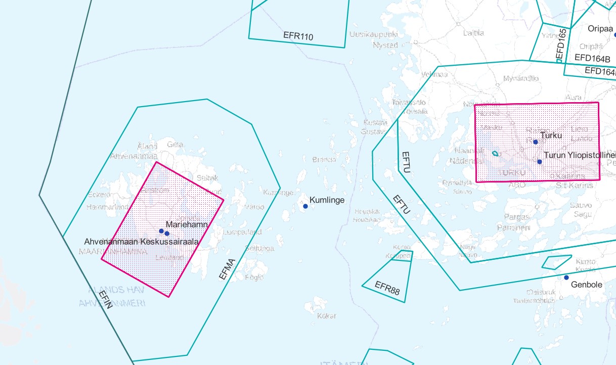
Air traffic network-product is a link-knot routing dataset compliant with INSPIRE requirements. It includes f.ex. flight routes and aerodromes. Data shall not be used for operational flight activities or flight planning. INSPIRE Air Traffic Network-product includes spatial information of air traffic network in accordance with the INSPIRE Directive. The data has been retrieved from the EAD database maintained by Eurocontrol. Information is updated regularly but is not constantly up to date. Data can be used for purposes that are in accordance with the INSPIRE Directive, but shall not be used for operational flight activities or flight planning. ANS Finland www.ais.fi –site provides information for operational flight activities or flight planning Available layers Aerodrome Node: Node located at the aerodrome reference point of an airport/heliport, which is used to represent it in a simplified way.DEFINITION Aerodrome Reference Point (ARP): The designated geographical location of an aerodrome, located near the initial or planned geometric centre of the aerodrome and normally remaining where originally established [AIXM3.3].DEFINITION Airport/heliport: A defined area on land or water (including any buildings, installations and equipment) intended to be used either wholly or in part for the arrival, departure and surface movement of aircraft/helicopters [AIXM5.0]. Air Route Link: A portion of a route to be flown usually without an intermediate stop, as defined by two consecutive significant points Air Space Area: A defined volume in the air, described as horizontal projection with vertical limits. Designated Point: A geographical location not marked by the site of a radio navigation aid, used in defining an ATS route, the flight path of an aircraft or for other navigation or ATS purposes. Instrument Approach Procedure: A series of predetermined manoeuvres by reference to flight instruments with specified protection from obstacles from the initial approach fix, or where applicable, from the beginning of a defined arrival route to a point from which a landing can be completed and thereafter, if a landing is not completed, to a position at which holding or en route obstacle clearance criteria apply. Navaid: One or more Navaid Equipments providing navigation services.DEFINITION Navaid equipment: A physical navaid equipment like VOR, DME, localizer, TACAN or etc. Procedure Link: A series of predetermined manoeuvres with specified protection from obstacles. Runway Area: A defined rectangular area on a land aerodrome/heliport prepared for the landing and take-off of aircraft. Runway Centerline Point: An operationally significant position on the center line of a runway direction. Standard Instrument Arrival: A designated instrument flight rule (IFR) arrival route linking a significant point, normally on an ATS route, with a point from which a published instrument approach procedure can be commenced. Standard Instrument Departure: A designated instrument flight rule (IFR) departure route linking the aerodrome or a specific runway of the aerodrome with a specified significant point, normally on a designated ATS route, at which the en-route phase of a flight commences. Surface Composition: Runway surface material CTR (Not INSPIRE): A control zone (CTR) is a block of Controlled Airspace extending from the surface of the earth to a specified upper limit.
-
A floating object moored to the bottom in a particular (charted) place, as an aid to navigation or for other specific purposes.
-
A point spatial object which is used to represent a sea or inland port in a simplified way, aproximately located at the bank of the waterbody where the port is placed.
-
A linear spatial object that describes the geometry or connectivity of the water transport network between two consecutive waterway or watercourse nodes. It represents a linear section across a body of water which is used for shipping.
-
A point spatial object which is used to represent the connectivity between two different waterway links, or between a waterway link and a watercourse link, in the water transport network.
-
An enclosure with a pair or series of gates used for raising or lowering vessels as they pass from one water level to another.
-
The main travelled part of a waterway.
-
A prominent specially constructed object forming a conspicuous mark as a fixed aid to navigation, or for use in hydrographic survey.
-

Rajoitusalueita ovat maastoliikennelain nojalla asetetut liikennerajoitukset. Rajoituspäätöksiä ovat antaneet aiemmin vanhat lääninhallitukset (vuoteen 1995 saakka), vapaakunnat (vuosina 1989-1996) ja vuodesta 1995 lähtien alueelliset ympäristökeskukset (nykyiset ELY-keskukset). Merenkulkulaitoksen ylläpitämiä yleisiä kulkuväyliä koskevia rajoituksia ovat tehneet vuoteen 1994 asti lääninhallitukset, vuodesta 1995 kesäkuun loppuun 1996 alueelliset ympäristökeskukset (nykyiset ELY-keskukset) ja sen jälkeen Merenkulkulaitoksen merenkulkupiirit. Aineisto koostuu maastoliikenteen rajoitusalueista. Alueiden rajausten lisäksi aineistot sisältävät tietoa itse päätöksistä ja niiden sisältämistä rajoituksista. Aineisto kuuluu SYKEn avoimiin aineistoihin (CC BY 4.0). Aineistosta on julkaistu INSPIRE-tietotuote. Tämä aineisto sisältää maastoliikenteen rajoituspäätökset, joista on saatu tiedot ELY-keskuksilta 8.4.2022 mennessä. Väyliä koskevat rajoitukset sekä väylien ulkopuoliset vesiliikennerajoitukset eivät ole mukana tässä aineistokokonaisuudessa. Niitä koskevien paikkatietoaineistojen ylläpitovastuu on Väylävirastolla, joka vastaa myös aineistojen jakelusta. (Väylien ulkopuolisten vesiliikennerajoitusten aineiston jakelu on siirtynyt Väyläviraston vastuulle 1.6.2020 alkaen. Aineisto poistui Syken avoimista aineistoista 6.4.2021 ja ympäristöhallinnon sisäisestä käytöstä 18.5.2021.) Käyttötarkoitus: Maastoliikennettä koskevien rajoitusten tarkasteluun paikkatietopohjaisesti. Rajoituspäätösten yksityiskohtaiset tiedot löytyvät päätösasiakirjoista. Lisätietoja: https://geoportal.ymparisto.fi/meta/julkinen/dokumentit/MaastoliikenneRajoitusalueet.pdf The dataset Land traffic restriction areas includes restriction areas based on the Land Traffic Act. Restriction definitions were given by old regional administrative courts till 1995, free municipalities (1989-1996) and from 1995 onwards local environmental centres (Centres for Economic Development, Transport and the Environment or ELY-centres). Restrictions regarding for public water courses maintained by Finnish Maritime Administration have been announced by the previous regional state administrative agencies, from 1995 till June 1996 by local environmental centres (ELY-centres) and after that navigation districts under the Finnish Maritime Administration. The dataset includes land traffic restriction areas and additional information on the related decisions and restrictions and exceptions for restrictions included in the decisions. The spatial dataset including waterway restrictions and the water traffic restriction decisions outside of waterways is maintained by the Finnish Transport Infrastructure Agency, which is responsible also for the distribution of the datasets.
-
A linear spatial object that describes the geometry and connectivity of a railway network between two points in the network.
 Paikkatietohakemisto