 Paikkatietohakemisto
Maanmittauslaitos
Type of resources
Available actions
Topics
Keywords
Contact for the resource
Provided by
Years
Formats
Representation types
Update frequencies
Service types
Scale
Resolution
-
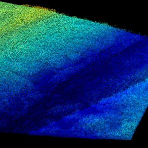
Laser scanning data refers to three-dimensional point-like data depicting the ground and objects on the ground. Each point is provided with x, y and z coordinate information. Laser scanning data 0.5 p has been spaced out from Laser scanning data 5 p's density of 5 p/m² to a density of 0.5 p/m². Laser scanning data 0.5 p is open data, and from 2020 onwards, it will be collected according to the national laser scanning programme (in Finnish): https://www.maanmittauslaitos.fi/laserkeilaus-ja-ilmakuvaus. For the time being, it is available only from certain parts of Finland. The product belongs to the open data of the National Land Survey of Finland. More information (in Finnish): https://www.maanmittauslaitos.fi/laserkeilausaineistot.
-
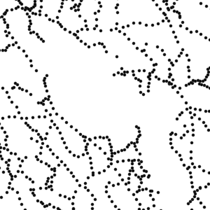
Control points and their coordinates and elevations define in practice the reference system for coordinates and elevations used in Finland. The NLS benchmark register contains information about nationwide control points and benchmarks. The marks are mainly horizontal and elevation control points in classes 1–3 measured by the National Land Survey of Finland. The product belongs to the open data of the National Land Survey of Finland.
-

Paikkatietohakemisto is a national metadata discovery service.
-
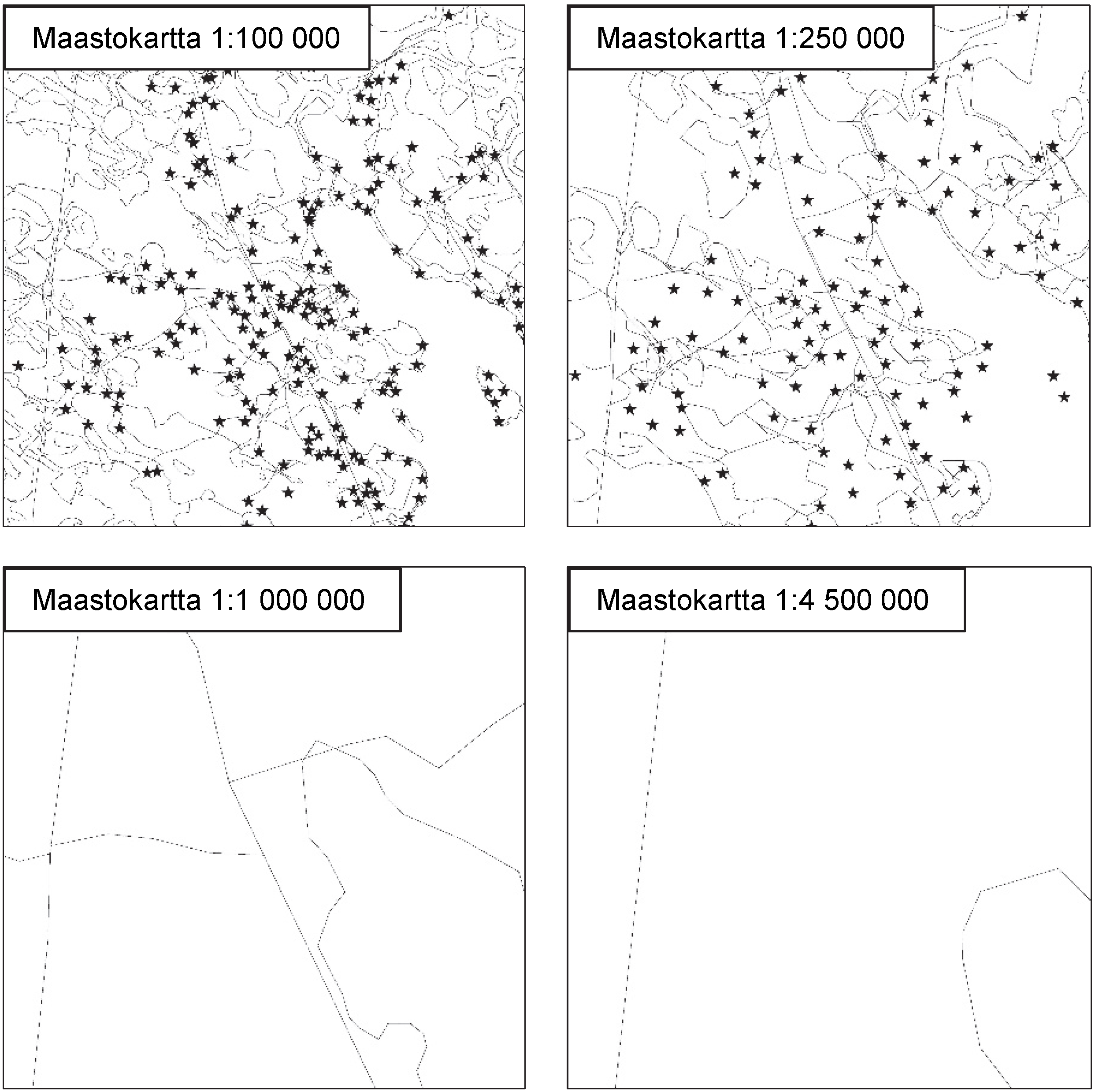
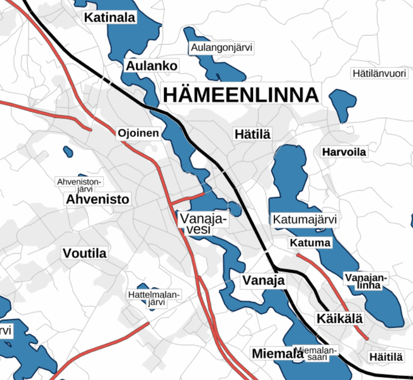
National Land Survey's Topographic map in vector format is a dataset depicting the terrain of all of Finland. The most important elements are the road network, administrative borders, preservation areas, population centres, geographic names, waterways, land use and elevation. The largest scale level (1:100,000) of the Topographic map in vector format is produced by generalising from the Topographic database. Topographic map 1:250,000 is produced by generalising the dataset 1:100,000. Topographic map 1:1,000,000 is produced by generalising the dataset 1:250,000. Topographic map 1:4,500,000 is produced by generalising the dataset 1:1,000,000. The geographic names have been generalised from the geographic names in the Geographic Names Register to map names suited to the scale in question. The administrative borders in the Municipal Division of each scale are used as administrative borders. The product belongs to the open data of the National Land Survey of Finland.
-
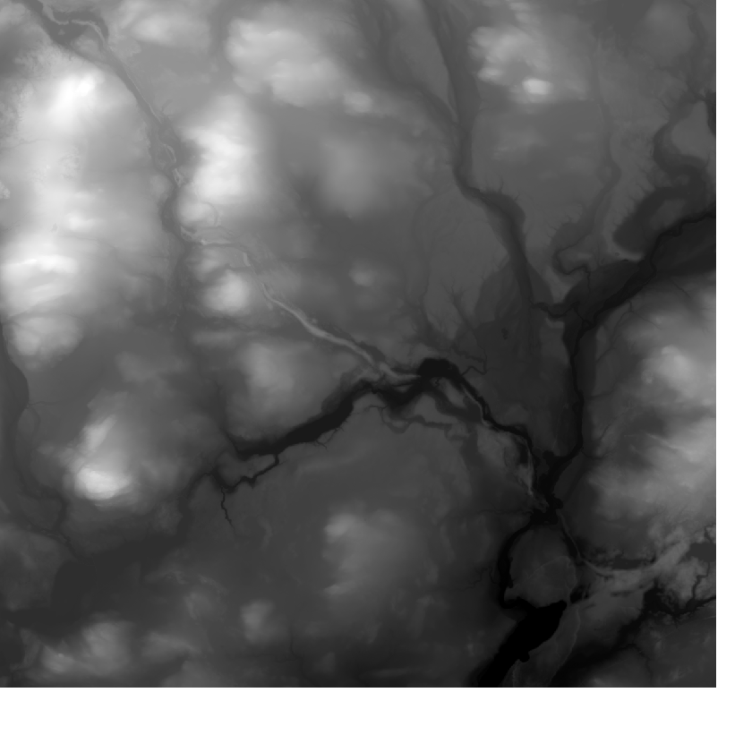
Elevation model 10 m depicts the elevation of the ground surface of the whole of Finland in relation to sea level. Its grid size is 10 m x 10 m and the accuracy of elevation data 1.4 metres. The product belongs to the open data of the National Land Survey of Finland.
-
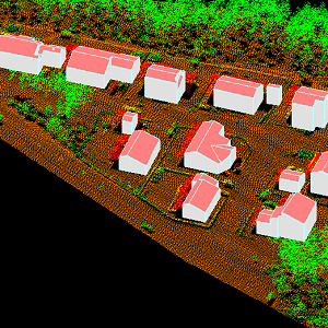
The 3D vectors for buildings are three-dimensional instances of the Building target category in the National Topographic Database (KMTK). The 3D vectors are produced with a high degree of automation from laser scanning data 5 p based on 2D vectors for buildings in KMTK. For the time being, data is available only from a few example areas, but the coverage will be extended to the whole of Finland as the laser scanning programme proceeds. The product belongs to the open data of the National Land Survey of Finland.
-

The Topographic database is a dataset depicting the terrain of all of Finland. The key objects in the Topographic database are the road network, buildings and constructions, administrative borders, geographic names, land use, waterways and elevation. Aerial photographs, scanning data and data provided by other data providers are utilised in updating the Topographic database. The updating is done in close cooperation with the municipalities. Field checks in the terrain are also needed to some extent, mostly as regards the classification of features. The topographic database is used in the production of other map products and in various optimisation tasks. The product belongs to the open data of the National Land Survey of Finland.
-
The Plain map series is a simple, plain and readable dataset product series in raster format that depicts the whole of Finland. The product is meant to be used as a background map whose character changes to a guide map in large scales. Impaired vision has been taken into account when designing the product. The key objects presented on the map are roads and railways, road names, buildings and constructions, administrative borders, waterways and other geographical names. The road network, public buildings and texts have been especially emphasised. The most usual limitations of colour vision have been taken into account in the use of colours. The product belongs to the open data of the National Land Survey of Finland.
-
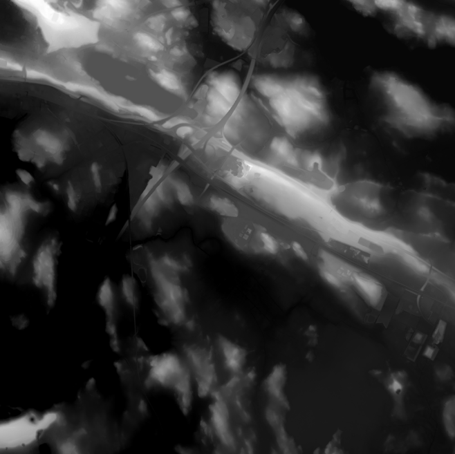
Elevation model 2 m is a model depicting the elevation of the ground surface in relation to sea level. Its grid size is 2 m x 2 m. The dataset is based on laser scanning data, the point density of which is at least 0.5 points per square metre. The product's coverage is based on nationwide laser scanning. In some parts of the outer archipelago or the eastern border, the elevation model is not available. Elevation model 2 m is produced in two quality classes: the elevation accuracy in class I is on average 0.3 metres and the elevation accuracy in class II varies between 0.3 metres and one metre. The product belongs to the open data of the National Land Survey of Finland.
-

Division into administrative areas (raster) is a dataset depicting the municipal Division of Finland. The dataset Municipal Division is produced in scales 1:10,000, 1:100,000, 1:250,000, 1:1,000,000 and 1:4,500,000. The data included in the dataset in scale 1:10,000 are taken from the Cadastre. Regarding other scales, municipal boundaries have been generalised to suit the scale in question. Division into administrative areas products in raster format include municipal boundaries only. The product is a part of the open data of the National Land Survey.